Egypt has coastlines on both the Mediterranean and the Red Sea. Egypt borders Libya to the west, the Gaza Strip and Israel to the northeast, and Sudan to the south. Its geological history has produced four major physical regions. The Nile Valley, the Nile Delta, The Western Desert and The Eastern Desert Sinai Peninsula.
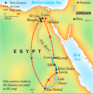
The Nile River was the freeway of Ancient Egypt. It provided vast amounts of fertile land and was the main route for travel. It was a great way to transport cattle, food and soldiers across the kingdom. Also, The Nile linked Egypt's provincial centers to its capital, Thebes. This enabled Egypt to function as an integrated kingdom, rather than a collection of independent provinces.
The Nile River was the freeway of Ancient Egypt. It provided vast amounts of fertile land and was the main route for travel. It was a great way to transport cattle, food and soldiers across the kingdom. Also, The Nile linked Egypt's provincial centers to its capital, Thebes. This enabled Egypt to function as an integrated kingdom, rather than a collection of independent provinces.
